Vector Geoprocessing Tools
These tools allow for tasks such as buffering, clipping, merging, intersecting, dissolving, and more. They provide the means to extract, transform, and analyze data within a geographic context, facilitating effective spatial analysis and decision-making processes.
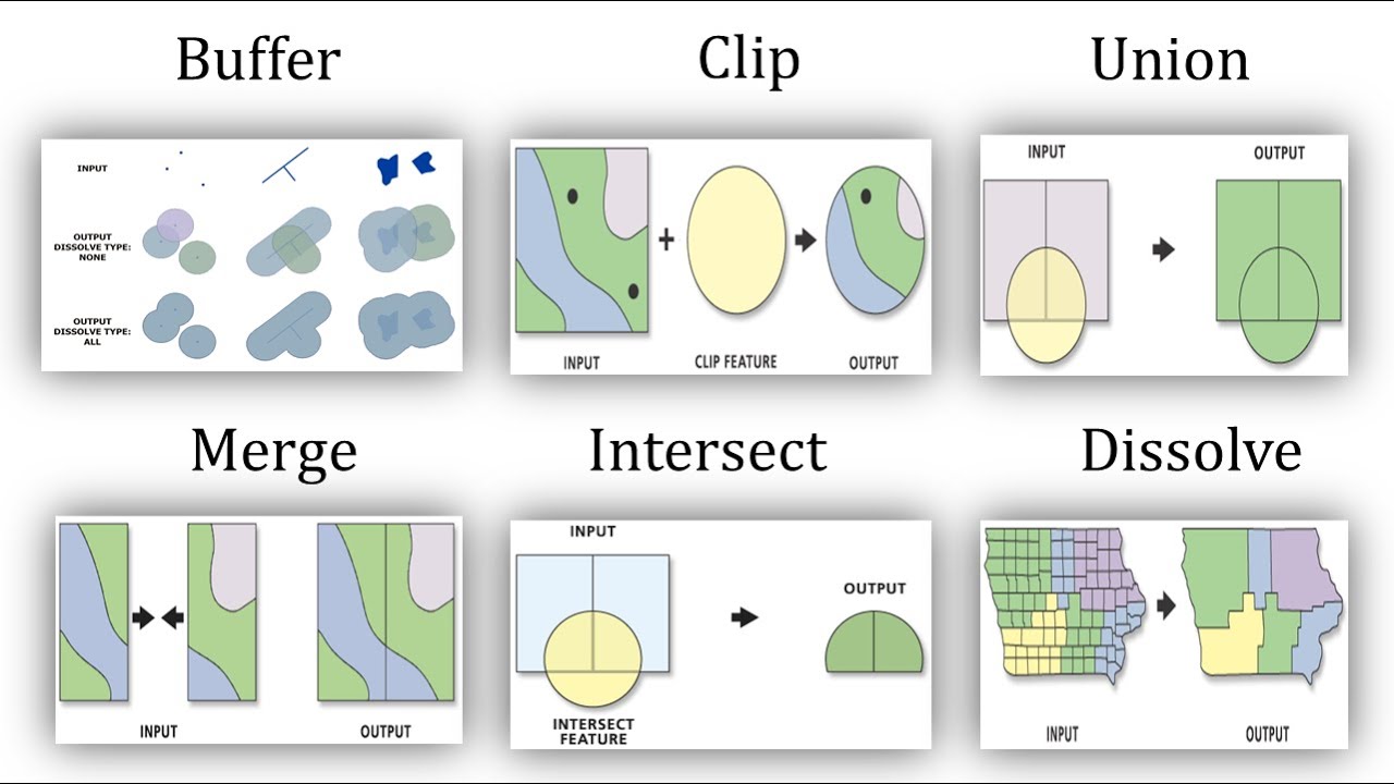
The photo above clearly shows the function of the 6 basic toolkits.
Basic six toolkits
- Buffer
- can create variable distance buffers based on attribute value
- use equidistant projection to center the point from that point, know the scale well and can draw buffer
- Clip
- large dataset to clip down into smaller subset/dataset
- not accepts more than 2 inputs at a time (only clip input dataset, another dataset can be clipped by)
- Union
- logical OR / inclusive or (inclusive of both conditions)
- merge overlapping or adjacent features into a single representation
- maintains all input feature boundaries and attributes in the output feature class
- it preserves features from both layers to the same extent
- 2 total input features and produce 5 output features
- Merge
- combines multiple input datasets of the same geometry type (points, lines, or polygons) into a (unified representation) single output dataset
- datasets have to be the same type
- number of features in the output is always the sum of all features in the input files
- Intersect
- logical AND
- operates on multiple vector datasets, determining and retaining the common features that intersect or overlap in all the datasets
- it is valid to intersect datasets with different geometry type
- it preserves attributes from all the data sets that overlap each other in the output
- accepts more than 2 inputs at a time, has 1 output feature
- Dissolve
- combines adjacent or overlapping vector features with the same attribute value into a single feature
- can be used to simplify and aggregate vector data by removing boundaries between adjacent features with identical attribute values


Comments
Post a Comment